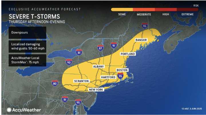
The timing for the system is the late afternoon and evening on Thursday, June 5, a day in which the temperature will climb into the upper 80s to even 90 degrees in some spots.
The range for possible storms is from northern New Jersey and Pennsylvania through most of New York, all of Connecticut and Massachusetts, and into northern New England, AccuWeather meteorologists say. (See the image above.)
Before the storm's arrival, a warming trend will kick in Tuesday, June 3, and continue throughout the week, according to the National Weather Service.
That will keep the possibility of more showers and storms possible beyond Thursday's system — on both Friday, June 6, and Saturday, June 7, with the most likely timing in the evening on both days.
Check back to Daily Voice for updates.
Click here to follow Daily Voice Scarsdale and receive free news updates.
